
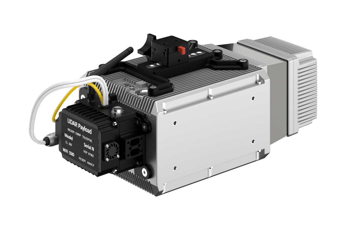
RESEPI LITE CL-360HD

RESEPI equipped with TELEDYNE’s CL-360HD LiDAR, is Inertial Labs’ entrance solution to the precision solution market. This powerful system will meet users’ needs, needing the best return count, range, beam divergence, accuracy, and precision. It offers a range of different laser scan speeds and frequencies, allowing users to easily tweak the settings to match the desired use case.
Overview
RESEPI (Remote Sensing Payload Instrument) is a sensor-fusion platform designed for accuracy-focused remote sensing applications. RESEPI utilizes a high-performance Inertial Labs INS (GPS-Aided Inertial Navigation System) with a tactical-grade IMU and a high-accuracy single or dual-antenna GNSS receiver, integrated with a Linux-based processing core and data-logging software. The platform also provides a WiFi interface, optional imaging module, and external cellular modem for RTCM corrections. RESEPI can be operated by a single hardware button or from a wirelessly connected device via a simple web interface.

Applications
System Specification
cm
System Vertical Accuracy
cm
Precision
cm
Precision
(1σ Noise Removal)
meters
Recommended AGL
kg
Weight with camera
cm
Dimensions
minutes
Max Flight Time (DJI M600)
(TB48S batteries)
GB
External Storage, USB Included
1GB RAM, 8GB eMMC
System Computer
Volt
Operational Voltage Range
Watt
Power Consumption
42W (@ 100 Hz)
47W (@ 250 Hz)
LiDAR Scanner
| Laser Range Capabilities (200kHz) |
205m @ 10% ref. 290m @ 20% ref. 490m @ 50% ref. 1.5 to 750m |
| Laser Range Capabilities (200kHz) |
130m @ 10% ref. 185m @ 20% ref. 250m @ 50% ref. 1.5 to 750m |
| Range Accuracy | +/- 5 cm |
| FOV (Horizontal) | 360° |
| FOV (Vertical) | N/A |
| Scan Angle (Vertical) | N/A |
| Beam Divergence | 0.17° (H) |
| Number of Laser | 1 |
| Number of Returns | 4 |
| Scan Speed | 50-250 lines/sec |
GPS-Aided INS
| IMU | Inertial Labs Tactical Grade IMU-P |
| GNSS | Dual Antenna |
| Constellations | GPS, GLONASS, Galileo, BeiDou, QZSS, NavIC (IRNSS), SBAS, L-Band |
| Frequencies | L1, L2, L5 |
| Operation Modes | RTK and PPK |
| Output Rates |
Up to 200HZ (INS) Up to 2,000HZ (IMU) |
| Pitch/Roll Accuracy |
0.03 (RTK) 0.004 (PPK) |
| Heading Accuracy |
0.1 (RTK) 0.02 (PPK) |
| Velocity Accuracy | <0.03 m/s |
| Position Accuracy |
1cm+1ppm (RTK) 0.5cm (PPK) |
Software
| Field Checks | Yes, Included |
| Pre-Processing | Yes, Included |
| Post-Processing | Yes, Supported |