
Process Data with Confidence in PCMasterPro
Advanced Software for Geospatial Data Processing
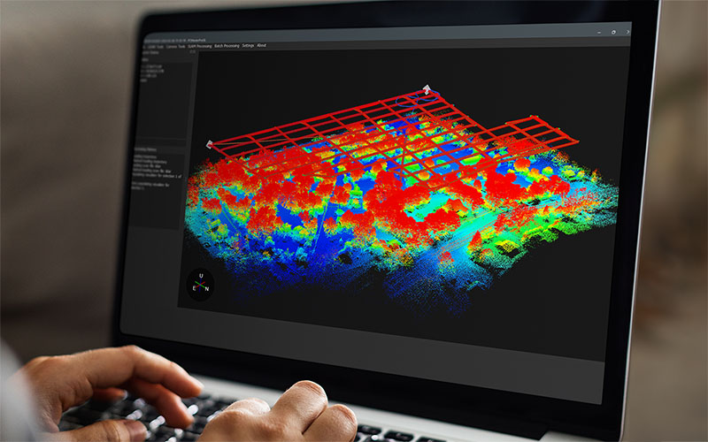
PCMasterPro is an advanced software solution designed for professionals working with geospatial and 3D data, including engineers, cartographers, surveyors, and even VFX designers. It offers powerful tools for processing trajectory data, generating 3D information, and evaluating deliverables critical for asset management. From tightly coupled inertial-based algorithms and reporting for land surveyors to locally referenced simultaneous localization and mapping (SLAM) generated point clouds for the VFX industry, PCMasterPro has the pre-processing and refinement tools to generate and investigate the deliverables needed for many common 3D industries.

This cutting-edge software integrates three of the most respected and well known technology partners’ offerings; each to serve their area of expertise in the industry:
- Tightly Coupled Inertial Fusion and Trajectory Processing powered by Waypoints’ Inertial Explorer from Hexagon
- SLAM (Simultaneous Localization and Mapping) powered by Kudan
- Strip Alignment powered by BayesMap StripAlign
- SurveyPro Tools – Powered by Inertial Labs
By combining these technologies, PCMasterPro provides users with a comprehensive and efficient solution for working with navigation and LiDAR data, even in challenging environments where GNSS signals may be unreliable or unavailable.
Core Features and Technologies in PCMasterPro
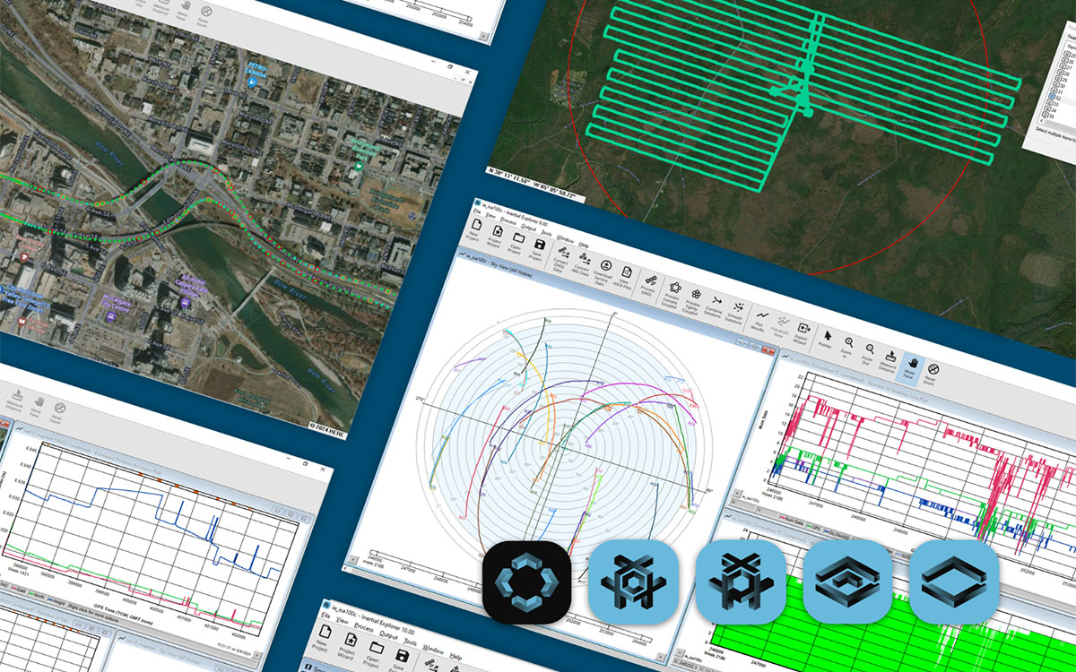
Trajectory Processing – Powered by Waypoints' Inertial Explorer from Hexagon
Proper Trajectory Processing involves the calculation and refinement of precise position based on the fusion of raw data from GNSS (Global Navigation Satellite System) and IMU (Inertial Measurement Unit) inputs. This is essential for accurate geospatial data, especially in dynamic environments.
PCMasterPro’s Trajectory Processing Capabilities
- Advanced post-processing of GNSS+IMU data for improved accuracy
- Automated lever arm refinement with 1mm accuracy
- Error correction and drift compensation
- Robust performance in environments with poor satellite visibility

SLAM (Simultaneous Localization and Mapping) – Powered by Kudan
SLAM technology enables devices to build a map of an environment while simultaneously determining their location within it. This is crucial for indoor navigation, autonomous vehicles, and even drone-based mapping where GNSS signals are weak or unavailable.
PCMasterPro’s SLAM Capabilities
- Real-time feedback during post-processed map generation
- Robust algorithms for high-accuracy positioning in GNSS-denied areas
- Enhanced localization using LiDAR and IMU data fusion
- Motion models that account for both IMU and LiDAR dependent error
- Improved trajectory consistency with existing mapping data
- Workflows and literature available for proper map merging and alignment with existing datasets
Strip Alignment – Powered by BayesMap
When LiDAR data is collected from moving platforms such as drones or aircraft, it is captured in multiple “strips.” These strips must be accurately aligned to prevent errors in the final point cloud. With RESEPI, powered by the best in class IMU’s from Inertial Labs, many customers will not have a need for further strip adjustment. However, for some endurance missions or for those who want to follow previously adopted best practices; we have integrated the industries best tool for strip adjustment to resource and equip for any operating procedure.
PCMasterPro’s Strip Alignment Capabilities
- Automated detection and correction of misaligned LiDAR strips
- Bayesian statistical methods for superior alignment precision
- Compensation for IMU and GNSS inaccuracies
- Enhanced point cloud quality for detailed mapping applications
- Report metrics on corrections and summary of findings
SurveyPro Tools – Powered by Inertial Labs
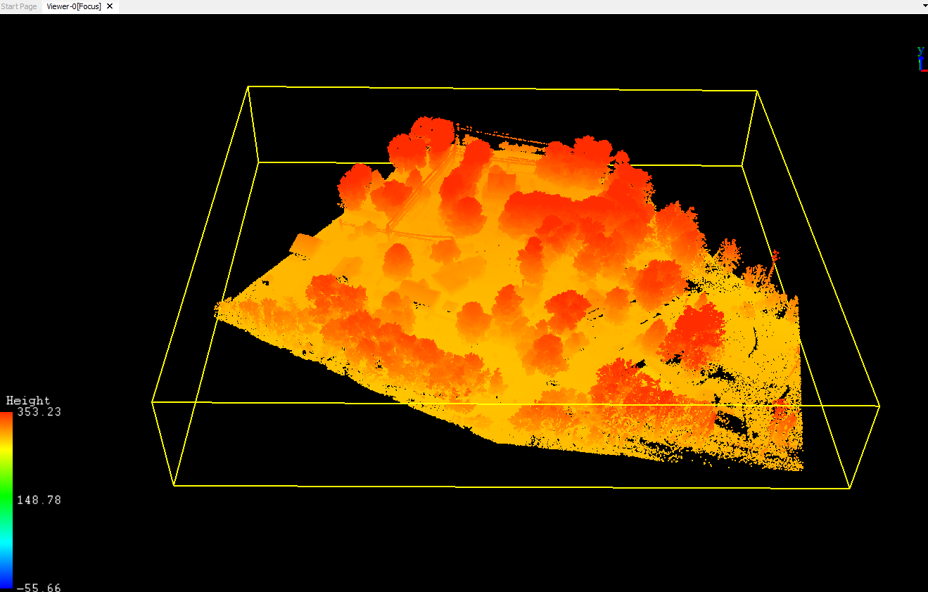
Creating point clouds is not the end of a standard workflow. Industries use these point clouds to create deliverables such as Digital Elevation Models (DEMs) like Digital Surface Models (DSMs) and Digital Terrain Models (DTMs). Through point cloud ground classification, these deliverables can easily be rendered to a users desired resolution. SurveyPro allows users to classify points, run accuracy assessments, and generate deliverables with ease.
PCMasterPro’s SurveyPro Tools Capabilities:
- Point Cloud Ground/Non-Ground Classification
- Accuracy Assessment and Reporting Using GCP’s
- Filtering, measurement and slicing tools to manipulate by range, position, vehicle dynamics, reflectivity or time
- ADEM Creation and Export (.tif format)
- New Export Data Formats: E57, PLY and PCD
PCMasterPro featuring SurveyPro runs a Simple Morphological Filter (SMRF) algorithm for classification. This is responsible for the generated deliverables within the surface and elevation models created. A SMRF methodology is known as a high-performance algorithm designed to automatically separate ground surfaces from obstacles like buildings and vegetation in 3D point cloud data. By applying advanced processing techniques to generate elevation and surface maps, it is a known and recognized methodology for providing a clean and reliable foundation for creating high-precision deliverables. It is exceptionally efficient and easy to tune, making it an ideal choice for professionals who need accurate terrain classification across diverse landscapes. Many alternative methods exist and for various conditions, tailored algorithms for specific use cases could provide better results, however in the end PCMasterPro implemented the SMRF method for ease of use, speed, efficiency, and best mass market accuracy and precision.
Plenty of Additional Features
Our software capabilities are ever-expanding based on customer needs. PCMasterPro has and continues to expand its supported feature sets to make sure that you have the right tools for the job.
PCMasterPro’s Expanding List of Features Include:
- Coordinate System Transformations: transform and align to your projects needs;
- Statistical Noise Filtering;
- Filtering, measurement and slicing tools to manipulate by range, position, vehicle dynamics, reflectivity or time;
- Boresight calibration features for advanced users;
- Automated trajectory path selection based on vehicle dynamics (heading deviations, length of swaths, etc.);
- Pre-Processing and Processing report generation for QC;
- Batch processing for scaling operations;
- Point Cloud Ground/Non-Ground classification;
- Import GCP’s and perform absolute accuracy assessments;
- DEM creation with .tif format;
- Real-time point cloud streaming via Ethernet or Wi-Fi;
- Image blending for more consistent cloud colorization.
Command Line Interface
Integrating PCMasterPro into Your Own Software
PCMasterPro offers a powerful Command Line Interface (CLI) that allows developers and businesses to embed its functionality directly into their own software solutions. This feature enables automation, customization, and seamless integration with existing workflows.
Key Benefits of PCMasterPro’s CLI
- Automation – Streamline complex data processing tasks with script-based execution
- Scalability – Process large datasets efficiently without manual intervention
- Flexibility – Integrate PCMasterPro’s capabilities into GIS platforms, mapping software, and other geospatial applications
- Customization – Modify workflows to meet specific project requirements
By leveraging the CLI, businesses can enhance productivity, reduce processing time, and achieve higher precision in their geospatial projects.
Why PCMasterPro Stands Out
PCMasterPro is a state-of-the-art geospatial data processing tool made for RESEPI that integrates the most advanced technologies for trajectory processing, SLAM, LiDAR strip alignment, and deliverable extraction, supporting a plethora of matured features for end-users like coordinate transformations, cloud filtering, DEM creation, ground classification, and GCP accuracy assessments. Its CLI support allows businesses to integrate and automate complex workflows efficiently and Batch Processing tools allow for easy scalability with your business.
Why Choose PCMasterPro?
Cutting-edge algorithms for highly accurate geospatial data processing
Seamless integration with existing GIS and mapping solutions
Designed for professionals who require precision and reliability
Future-proof technology that keeps pace with industry advancements
Whether you are working on aerial surveys, autonomous navigation, or 3D mapping, PCMasterPro provides the tools and flexibility to achieve outstanding results. Stay ahead with PCMasterPro – the next generation of geospatial data processing!
How to Get Started
To access PCMasterPro installers, firmware, and drivers, please Log In or Register for an account. If you have any questions or need assistance, please Contact Us.