
RESEPI LITE VLP-32C

Overview
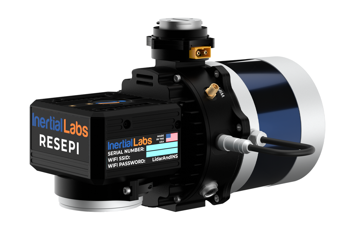
RESEPI™ (Remote Sensing Payload Instrument) is a sensor-fusion platform for accuracy-focused remote sensing applications. RESEPI utilizes a high-performance Inertial Labs INS (GPS-Aided Inertial Navigation System) with a tactical-grade IMU and a high-accuracy single or dual-antenna GNSS receiver, integrated with a Linux-based processing core and data-logging software. The platform also provides a WiFi interface, optional imaging module, and external cellular modem for RTCM corrections. RESEPI can be operated by a single hardware button or from a wirelessly connected device via a simple web interface.

Applications
The RESEPI VLP-32 was strategically integrated for its high vertical FOV of 40° and low beam divergence of 0.17° (H), 0.09° (V) for multiple application bases with mounting options for mobile vehicles, DJI-supported drones (DJI M300, M600 Pro), custom drones, handheld platforms, autonomous vehicles, the Freefly Alta-X, and many more. Because of this diverse mounting portfolio and its 360 FOV, the RESEPI can be used for many services, including construction volumetrics, site surveying, precision agriculture, forestry, and much more.
System Specification
cm
System Vertical Accuracy
cm
Precision
cm
Precision
(1σ Noise Removal)
meters
Recommended AGL
kg
Weight with camera
(1.4 kg without camera)
cm
Dimensions
minutes
Max Flight Time (DJI M300)
GB
External Storage, USB Included
1GB RAM, 8GB eMMC
System Computer
Volt
Operational Voltage Range
Watt
Power Consumption
LiDAR Scanner
| Laser Range Capabilities |
1.0m (min. range) 200m (max. range) 4mm (resolution) |
| Range Accuracy | +/- 3 cm |
| FOV (Horizontal) | 360° |
| FOV (Vertical) | 40° |
| Scan Angle (Vertical) | -25° to 15° |
| Beam Divergence |
0.17° (H) 0.09° (V) |
| Number of Laser | 32 |
| Number of Returns | 2 |
| Pulse Rate |
600 k/s (single return) 1200 k/s (dual return) |
Camera
| Model | 24MP RGB Mapping Camera |
| Lens | Sony E-Mount 16mm, 70° FOV |
| Max Trigger Rate | 2 seconds |
| External Camera Support | Yes |
GPS-Aided INS
| IMU | Inertial Labs Tactical Grade IMU-P |
| GNSS | Single or Dual Antenna |
| Constellations | GPS, GLONASS, Galileo, BeiDou, QZSS, NavIC (IRNSS), SBAS, L-Band |
| Frequencies | L1, L2, L5 |
| Operation Modes | RTK and PPK |
| Output Rates |
Up to 200HZ (INS) Up to 2,000HZ (IMU) |
| Pitch/Roll Accuracy |
0.03 (RTK) 0.004 (PPK) |
| Heading Accuracy |
0.1 (RTK) 0.02 (PPK) |
| Velocity Accuracy | <0.03 m/s |
| Position Accuracy |
1cm + 1ppm (RTK) 0.5cm (PPK) |
Software
| Field Checks | Yes, Included |
| Pre-Processing | Yes, Included |
| Post-Processing | Yes, Supported |